


Meadow Voting District, Snohomish County, Washington
About
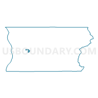
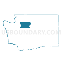
Outline

Summary
| Unique Area Identifier | 689125 |
| Name | Meadow Voting District |
| County | Snohomish County |
| State | Washington |
| Area (square miles) | 2.64 |
| Land Area (square miles) | 2.62 |
| Water Area (square miles) | 0.01 |
| % of Land Area | 99.49 |
| % of Water Area | 0.51 |
| Latitude of the Internal Point | 48.02940160 |
| Longtitude of the Internal Point | -122.04746350 |
Maps

Graphs
Select a template below for downloading or customizing gragh for Meadow Voting District, Snohomish County, Washington


Neighbors
Neighoring Voting District (by Name) Neighboring Voting District on the Map
- Cassidy Voting District, Snohomish County, WA
- Greenwood Voting District, Snohomish County, WA
- Hartford Voting District, Snohomish County, WA
- Lake Stevens 10 Voting District, Snohomish County, WA
- Lake Stevens 3 Voting District, Snohomish County, WA
- Lake Stevens 5 Voting District, Snohomish County, WA
- Lake Stevens 7 Voting District, Snohomish County, WA
- Lake Stevens 8 Voting District, Snohomish County, WA
- Lake Stevens 9 Voting District, Snohomish County, WA
- Lochsloy Voting District, Snohomish County, WA
- Pilchuck Voting District, Snohomish County, WA
- Ridgeway Voting District, Snohomish County, WA
- Sunnyside Voting District, Snohomish County, WA
Top 10 Neighboring County Subdivision (by Population) Neighboring County Subdivision on the Map
- Marysville CCD, Snohomish County, WA (67,930)
- Lake Stevens CCD, Snohomish County, WA (23,492)
- Granite Falls CCD, Snohomish County, WA (13,608)
Top 10 Neighboring Place (by Population) Neighboring Place on the Map
- Lake Stevens city, WA (28,069)
- Lake Cassidy CDP, WA (3,415)
- Lochsloy CDP, WA (2,533)
- Machias CDP, WA (1,178)
Top 10 Neighboring Unified School District (by Population) Neighboring Unified School District on the Map
Top 10 Neighboring State Legislative District Lower Chamber (by Population) Neighboring State Legislative District Lower Chamber on the Map
Top 10 Neighboring State Legislative District Upper Chamber (by Population) Neighboring State Legislative District Upper Chamber on the Map
Top 10 Neighboring 111th Congressional District (by Population) Neighboring 111th Congressional District on the Map
Top 10 Neighboring Census Tract (by Population) Neighboring Census Tract on the Map
- Census Tract 527.05, Snohomish County, WA (7,206)
- Census Tract 526.05, Snohomish County, WA (5,842)
- Census Tract 526.06, Snohomish County, WA (5,125)
- Census Tract 536.03, Snohomish County, WA (3,848)
- Census Tract 527.07, Snohomish County, WA (3,554)
- Census Tract 526.03, Snohomish County, WA (2,434)